Jacobabad
Jacobabad ( and جيڪب آباد; formerly Khanger or Khangarh) is a city in Sindh, Pakistan, serving as both the capital city of Jacobabad District and the administrative center of Jacobabad Taluka, an administrative subdivision of the district. The city itself is subdivided into eight Union Councils. Sitting far to the northwest of the province, near the provincial boundaries of Sindh and Balochistan, Jacobabad became a city on the site of an existing village (Khangarh), and is crossed by the Pakistan Railways and many main roads of the province. It is the 43rd most populous city in Pakistan.
The city is one of the hottest places on earth, with summer temperatures regularly rising to a mean temperature of 37 C. In particular, compounded by the humidity and climate change, Jacobabad has several times exceeded a wet-bulb temperature of 35 C, above which the human body cannot sufficiently cool itself. Jacobabad has been cited as one of the world's most vulnerable places to global warming, and one where the difference between 1.5°C and 2°C can be the difference between life and death.
The city is named after Brigadier-General John Jacob CB (1812–1858), an officer of the British East India Company who ruled this region during the last decade of his life. He is also known for the cavalry regiment called 36th Jacob's Horse. Jacobs was a graduate of Addiscombe Military Seminary. He was commissioned into the Bombay Artillery (Bombay Army) on his 16th birthday, and subsequently sailed for India in January 1828, never to set foot in England again. According to travel writer Salman Rashid, it was local residents "who took to calling the new settlement ‘Jekumbad’", later renamed to Jacobabad by the British rulers. The scale of progress and prosperity Jacob's works brought to the region can be appreciated by comparing those regions' relative prosperity at the time, compared to areas which were not under his administrative jurisdiction.
Map - Jacobabad
Map
Country - Pakistan
 |
 |
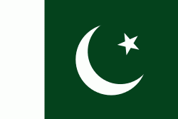
| Flag of Pakistan | |
Pakistan is the site of several ancient cultures, including the 8,500-year-old Neolithic site of Mehrgarh in Balochistan, the Indus Valley civilisation of the Bronze Age, the most extensive of the civilisations of the Afro-Eurasia, and the ancient Gandhara civilization. The region that comprises the modern state of Pakistan was the realm of multiple empires and dynasties, including the Achaemenid; briefly that of Alexander the Great; the Seleucid, the Maurya, the Kushan, the Gupta; the Umayyad Caliphate in its southern regions, the Hindu Shahis, the Ghaznavids, the Delhi Sultanate, the Mughals, the Durranis, the Omani Empire, the Sikh Empire, British East India Company rule, and most recently, the British Indian Empire from 1858 to 1947.
Currency / Language
| ISO | Currency | Symbol | Significant figures |
|---|---|---|---|
| PKR | Pakistani rupee | ₨ | 2 |
| ISO | Language |
|---|---|
| EN | English language |
| PA | Panjabi language |
| PS | Pashto language |
| SD | Sindhi language |
| UR | Urdu |


